


Waterproof Chart - Inshore Fishing Chart - Whitewater Bay / Everglades #40F
- Available for Local Pickup
Description:
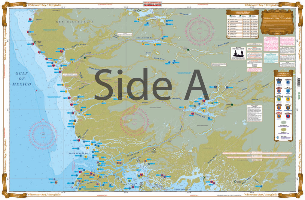
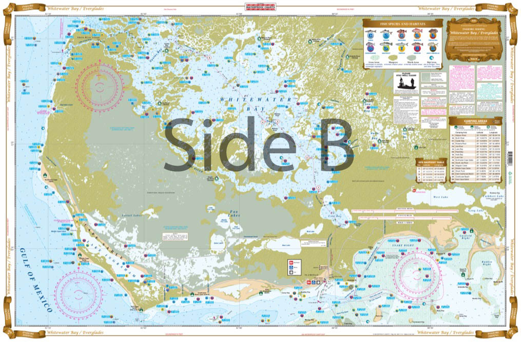
Complete coverage from Garfield Bight (just east of Flamingo) to Little Shark River with Large Print detail for all of Whitewater Bay on side B. On the reverse Side A you get coverage from Little Shark River to Highlands Beach (just east of Lostmans River) with excellent detail of Broad River, Harney River, Tarpon Bay and lots more. Like all of our Inshore Fishing Charts this special chart details all of the major fishing areas with species specific locations. For the Kayaker and Campers we have listed all of the Park Camping Sites with GPS Coordinates and we have highlighted the Wilderness Waterway, as well as the CANOE TRAIL from Coot Bay to East Cape Canal. This is a Chart you can have as much fun at home planning your next adventure or remembering the last trip there. NO ONE HAS A BETTER CHART OF THE EVERGLADES. No ONE !!!!! We have your Everglades fishing needs covered! Hook, line, and sinker.
Nautical Chart is 25″ X 38″. WGS84 – World Mercator Datum.
Local Fishing Spots
Marinas
Kayak Trails
Boat Ramps
Grass Flats
Camping Areas
NOAA Resources
Products are available for purchase in-store at our Shop located at:
Purchase Online with shipping or local pickup!
Free Local Delivery is available with the purchase of Kayaks & Paddleboards in Naples & Marco Island
